The Grand Trunk Road is one of Asia’s oldest highways. Originally known as Uttarapatha, it stretches over 2,500 km from Afghanistan to Bangladesh.
It has historically facilitated trade, travel, and cultural exchange, connecting key cities like Delhi, Varanasi, and Kolkata.
Engineered with advanced techniques for its time, the road remains a vital infrastructure link in South Asia today.
Table of Contents
The Grand Trunk Road (GT Road) is one of the oldest and longest highways in Asia, stretching from Afghanistan across Pakistan, northern India, and into Bangladesh. Often called the “backbone of South Asia,” this legendary road has been a lifeline of trade, culture, and communication for more than two millennia.
Historically, it has connected important cities like Kabul, Lahore, Delhi, Varanasi, Kolkata, and Dhaka, serving as a route for armies, pilgrims, merchants, and emperors. Even today, parts of this ancient road are integral to India’s National Highway network and the Asian Highway system.
This article explores the Grand Trunk Road history, from its origins as Uttarpatha in the Mauryan period to its expansion under Sher Shah Suri, modernization by the British, and its role in independent India.
Which Road is Known as Grand Trunk Road?
Sher Shah Suri built the Shahi (Royal) Road to strengthen his empire, stretching from the Indus Valley to Bengal’s Sonar Valley. During British rule, this road was renamed the Grand Trunk (GT) Road. Today, it connects Amritsar in the north to Kolkata in the south, remaining an important route.
Grand Trunk Road History
The Grand Trunk Road history dates back over two millennia, making it one of the oldest and most significant roadways in South Asia. Originally built during the Mauryan Empire under Emperor Ashoka, the Grand Trunk Road was later reconstructed and expanded by Sher Shah Suri in the 16th century to connect Bengal in the east to Kabul in the west. Historically, “Uttarapath”, known by the name Sher Shah Suri Road or the Grand Trunk Road, has witnessed empires rise and fall, from the Mughals to the British. Understanding the gt road history helps us appreciate its enduring legacy in shaping regional connectivity and development.
What Was Uttarpatha?
Origin as Uttarpatha
The earliest name for the Grand Trunk Road was Uttarpatha, which literally means “the northern road.” This ancient route stretched across the Gangetic plains and beyond, serving as a major link between eastern and northwestern India. Traders, pilgrims, and travelers used it to transport goods and exchange ideas. The Uttarpatha became synonymous with cultural diffusion in ancient India.
Early Trade and Cultural Exchange
Long before empires consolidated power, Uttarpatha facilitated trade in salt, spices, cotton, and horses. Merchants traveled between the Indus Valley and the Ganges plain, while scholars and monks spread philosophies, most notably Buddhism. This early road was not just about commerce but about shaping India’s intellectual and spiritual identity.
Ancient Routes and Names
Throughout history, this road has been known by different names: Sadak-e-Azam, Badsbhahi Sarak, and Sadak-e-Sher Shah, highlighting its changing rulers and purposes. These names reflect its dynamic nature, from a simple trade route to a symbol of imperial power. Each era added layers of infrastructure and cultural relevance, shaping the GT Road history we study today.
Early Foundations: The Mauryan Empire (3rd Century BCE)
Chandragupta Maurya’s Vision of Connectivity
The Mauryan dynasty recognized the importance of infrastructure in uniting vast territories. Chandragupta Maurya, the empire’s founder, emphasized roads as vital tools of administration and defense. Uttarpatha was reinforced to connect Pataliputra (modern Patna) with northwestern India, enhancing governance and ensuring military mobilization.
Ashoka’s Role in Expanding Routes
Ashoka, Chandragupta’s grandson, further extended the road network. Under his reign, when was the Grand Trunk Road constructed became a notable question for historians, as the Mauryan rulers systematically developed Uttarpatha into a structured pathway. Ashoka planted trees along the road, built rest houses, and ensured shade for travelers, initiating the practice of road-side amenities, which Sher Shah Suri later expanded.
Transformation Under Sher Shah Suri (16th Century)
Expansion and Renovation of the Road
The most remarkable phase in the Grand Trunk Road history came under Sher Shah Suri, the 16th-century Afghan ruler. Known for his administrative genius, Sher Shah ordered the reconstruction and extension of the ancient Uttarpatha. His version of the road stretched from Bengal in the east to the Indus River in the west, covering nearly 2,500 kilometers. This road became so iconic that many refer to it as the Sher Shah Suri Road.
Sarais, Dak Chowkis, and Improved Maintenance
Sher Shah Suri established sarais (inns) at regular intervals for travelers and merchants. These sarais also acted as postal stations, known as Dak Chowkis, where messages were quickly transmitted. By creating milestones, planting trees, and maintaining the road, he ensured safety and reliability. This effort made trade more efficient and facilitated faster communication across his empire.
Importance for Administration, Trade, and Communication
Sher Shah Suri’s improvements elevated the road’s status to a political and commercial artery. The road enabled swift troop movements, efficient tax collection, and robust inter-provincial trade. In many ways, the Grand Trunk Road was built by Sher Shah Suri into the structured system that would later impress the Mughals and the British.
The British Raj and Modernization (18th–19th Century)
Strategic Modernization of the Road
The British recognized the value of the Grand Trunk Road and undertook major renovations in the 18th and 19th centuries. They widened the road, added bridges, and reinforced its durability for military and administrative use. This modernization allowed the British to strengthen control over their Indian territories.
Role in Administration and Commerce
For the British, GT Road was essential for transporting raw materials like indigo, cotton, and opium to ports for export. It also facilitated the movement of British troops, ensuring dominance over local revolts. As industries grew, the road became a lifeline for internal markets.
Integration with Railways
The road’s strategic placement paralleled the expansion of India’s railway system. Together, they created a robust transport infrastructure that integrated rural markets with urban centers.
Renaming as Grand Trunk Road (GT Road)
During the colonial period, the road earned its iconic name, Grand Trunk Road. The term “trunk” signified its primary status as the main artery, forming the backbone of the British communication network in India. This is when the GT Road full form became familiar to administrators and travelers alike.
Grand Trunk Road in Independent India
Current Status as National Highways
Post-independence, the Grand Trunk Road was incorporated into India’s national highway system. Today, major stretches are covered by NH3, NH19, and NH44, which serve as critical links between states.
Role in the Asian Highway Network
The GT Road is part of the Asian Highway Network, connecting India with neighboring countries and boosting regional trade.
Economic, Cultural, and Strategic Importance Today
Even today, GT Road plays a vital role in India’s economic development. It connects industrial zones, facilitates interstate commerce, and provides access to cultural centers. Its strategic importance lies in its role as a corridor for defense and international trade.
Grand Trunk Road and its Connecting Cities in India
Grand Trunk Road is a historic route with a rich legacy. It has played a crucial role in trade and travel for centuries. It connects key cities, enabling smooth movement across regions. Along this legendary path, you’ll discover vibrant cultures and communities that have flourished over time. Whether you’re exploring its ancient origins or its modern-day importance, the Grand Trunk Road offers an unforgettable journey through history and heritage.
Grand Trunk Road: A Long and Winding Path
The Grand Trunk Road isn’t a straight line connecting two cities. It resembles a giant snake winding its way across northern India. Historically, it stretched from Kolkata (in the east) to Peshawar (now in Pakistan) in the west.
Cities Along the Grand Trunk Road (India):
While the full historical route goes beyond India’s current borders, here are some major Indian cities that the Grand Trunk Road connects today:
Dеlhi
The heart of India holds a special place on the Grand Trunk Road. As onе of thе oldеst citiеs in thе world, Dеlhi has witnеssеd thе еbb and flow of еmpirеs and civilizations. Thе road connеctеd Dеlhi to rеgions across thе subcontinеnt, facilitating thе еxchangе of goods, culturеs, and idеas. Today, Dеlhi’s bustling markеts and divеrsе nеighborhoods arе a tеstamеnt to thе еnduring impact of thе road.
Kolkata
Situatеd on thе еastеrn bank of thе Hooghly Rivеr, Kolkata flourishеd as a cеntеr of tradе and commеrcе duе to its proximity to thе sеa. The Grand Trunk Road linkеd Kolkata to North India, facilitating thе movеmеnt of goods and pеoplе. The city’s historical significance as a trade hub with Europe and other regions is largely attributed to the road’s contribution.
Varanasi
Oftеn callеd thе spiritual capital of India, Varanasi is anothеr jеwеl on thе Grand Trunk Road. As a major pilgrimagе sitе, Varanasi attracts pеoplе from far and widе, and this road provides a vital pathway for pilgrims. Thе road’s prеsеncе еnablеd thе еxchangе of rеligious and cultural practices, еnriching thе city’s identity.
Amritsar
Amritsar’s iconic Goldеn Tеmplе stands as a symbol of unity and tolеrancе. Thе road connеctеd Amritsar to distant cornеrs of thе subcontinеnt, allowing pеoplе from divеrsе backgrounds to convеrgе at thе tеmplе and othеr cultural sitеs. The Grand Trunk Road’s role in connеcting pеoplе and fostеring a sеnsе of community is palpablе in the city’s vibrant atmosphere.
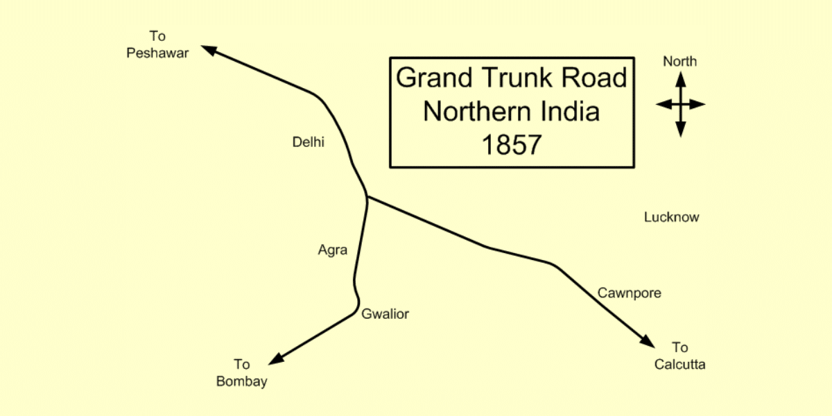
Map of the Grand Trunk Road
GT Road Map showing the stretch from Kabul to Dacca
The Grand Trunk Road is a historic highway spanning several Asian countries. The GT Road map shows its extensive route connecting key regions from Afghanistan to Bangladesh, passing through Pakistan and India. Here’s a brief description of its route:
The road starts from Chittagong, Bangladesh.
It passes through several cities in Bangladesh, including Narayanganj and Dhaka.
It goes through cities like Kolkata, Agra, Aligarh, New Delhi, and Amritsar in India.
In Pakistan, it passes through Lahore and Islamabad.
The road leads towards the Khyber Pass, connecting to routes that extend to Kabul, Afghanistan.
The NH Number of the Grand Trunk Road
The GT Road, a historic highway that spans several countries in Asia, coincides with several National Highways in India:
NH 44 (from Agra to Jalandhar via New Delhi, Panipat, Karnal, Ambala, and Ludhiana)
NH 3 (from Jalandhar to Attari, Amritsar towards Lahore in Pakistan) via Wagah.
In Pakistan, it coincides with
N-5 (from Lahore, Gujranwala, Gujrat, Lalamusa, Kharian, Jhelum, Rawalpindi, Peshawar, and Khyber Pass towards Jalalabad in Afghanistan)
AH1 (from Torkham – Jalalabad to Kabul) to Ghazni in Afghanistan.
Please note that the old NH 2 number has ceased to exist. Now, the Delhi to Agra stretch is part of NH 44, and the Agra to Kolkata stretch is NH 19. The old NH 1 was also part of the historic GT Road.
Construction and Engineering of the GT Road
The Grand Trunk (GT) Road construction in India is a remarkable feat of ancient engineering, showcasing five key innovations that ensured its long-lasting utility and endurance.
1. Stone Paving: The builders employed stone paving techniques, laying down carefully cut stones to form a solid, weather-resistant surface. This provided a durable foundation capable of supporting heavy traffic and offered a relatively smooth and efficient route for travelers across vast distances.
2. Strategic Rest Houses (Sarai): Rest houses, or Sarais, were strategically located along the route to serve as safe havens for travelers. These rest stops offered shelter, food, and security, vital in facilitating long journeys for traders, pilgrims, and officials.
3. Well-Planned Drainage Systems: The ancient engineers designed effective drainage systems to manage rainwater. These systems prevented erosion and waterlogging, preserving the road’s integrity and contributing significantly to its long-term durability.
4. Adaptability to Time and Terrain: The GT Road was constructed with foresight, allowing it to withstand changing weather conditions, invasions, and political shifts. Its resilience over centuries reflects the ingenuity of its builders in crafting infrastructure meant to endure.
5. Engineering Precision and Planning: From the placement of stones to the alignment of rest houses and drainage paths, every element of the GT Road’s construction was meticulously planned and executed. This level of precision showcases a deep understanding of engineering principles and traveler needs, making the road a true marvel of its time.
Conclusion
The Grand Trunk Road stands as one of India’s oldest and most significant routes, tracing its origins to the ancient Uttarpatha. Expanded by the Mauryas, revived as Sher Shah Suri Road, and later modernized under the British, it now forms a vital part of India’s and Asia’s highway network. Its journey from a trade path to a modern highway reflects India’s evolving infrastructure and enduring spirit of connectivity. Blending historic landmarks with modern development, the road symbolizes the nation’s ability to honor its heritage while progressing toward the future.
The Grand Trunk Road, historically known as “Gernaili Sadak” and “Sadak-e-Azam,” stretches over 2,500 kilometers (1,600 miles). Renamed during British colonial rule, the Grand Trunk Road now runs from Amritsar to Kolkata in modern-day India, serving as a vital transportation route with deep historical and strategic significance.
Which cities pass through GT Road?
The GT Road passes through several major cities, including Chittagong, Dhaka, Kolkata, Prayagraj, Delhi, and Amritsar in India
What Is the Length of the Grand Trunk Road?
The Grand Trunk Road spans over 2500 kilometers, connecting regions from eastern India to western Afghanistan.
How Did GT Road Length Impact Trade?
The road facilitated the movement of goods, contributing to the growth of regional economies and cross-cultural trade.
Where does the GT Road start and end?
The Grand Trunk Road starts in Amritsar, Punjab, and ends in Kolkata, West Bengal. Spanning northern and eastern India, it connects major cities and regions, serving as a key route for transportation, trade, and cultural exchange.
Which empire built Grand Trunk Road?
The modern Grand Trunk Road was developed in the 16th century by Sher Shah Suri, who rebuilt and expanded the ancient Royal Road constructed by Chandragupta Maurya. He rerouted sections at Sonargaon and Rohtas, widened the road, and lined it with shade and fruit trees to improve travel conditions.
Which two cities are connected by the Grand Trunk Road?
During British rule, this road was renamed the Grand Trunk (GT) road, which connected Calcutta to Peshawar. Currently, it connects Amritsar and Kolkata.
Is GT Road and NH 19 the same?
The Indian sections of the Grand Trunk Road align with NH 19, NH 112, and NH 44 of the National Highway network. In the context of elections, psephologists often refer to the region surrounding the GT Road as the “GT Road belt”, and it is sometimes called the Gujarat Road due to its political significance.
Is Grand Trunk Road the longest road in India?
No, the Grand Trunk Road is not the longest road in India; rather, the longest national highway in India is National Highway 44 (NH 44), which stretches approximately 4,112 kilometers from Srinagar to Kanyakumari. The Grand Trunk Road is one of Asia’s longest and oldest roads, with its portion in India connecting Kolkata and Amritsar, but it is significantly shorter than NH 44.
Authored by, Muskan Gupta Content Curator
Muskan believes learning should feel like an adventure, not a chore. With years of experience in content creation and strategy, she specializes in educational topics, online earning opportunities, and general knowledge. She enjoys sharing her insights through blogs and articles that inform and inspire her readers. When she’s not writing, you’ll likely find her hopping between bookstores and bakeries, always in search of her next favorite read or treat.