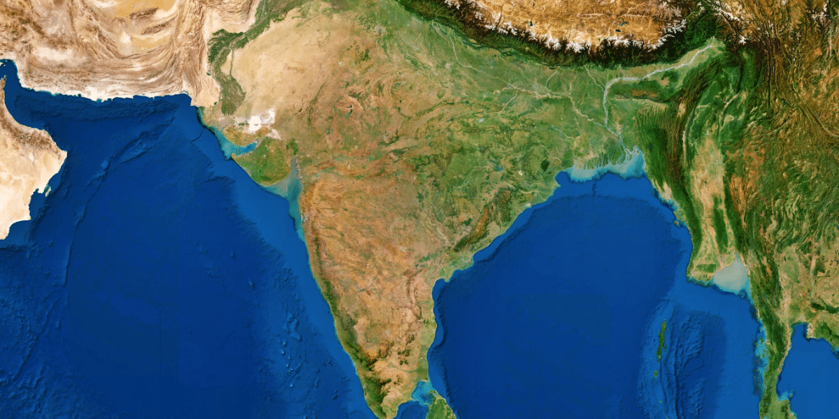
India is a vast country with remarkable diversity in its physical features. The land is not uniform but divided into distinct physiographic divisions of India, natural regions shaped by geological history and physical geography. These divisions help us understand why the Himalayas rise in the north, fertile plains stretch across the center, plateaus dominate the south, deserts expand in the west, and coastal areas line the east and west.
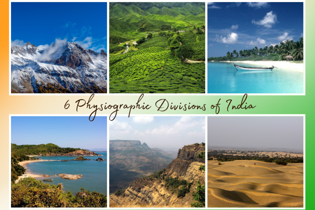
The origin of these landforms lies in plate tectonics and geological evolution. India was once part of Gondwanaland, and its collision with the Eurasian Plate gave birth to the Himalayas. Over millions of years, rivers, erosion, and tectonic movements further molded the surface into six major physiographic divisions: the Northern Mountains, Indo-Gangetic Plains, Peninsular Plateau, Indian Desert, Coastal Plains, and Islands.
These divisions are crucial as they influence climate, river systems, agriculture, settlement, and biodiversity. For instance, the Indo-Gangetic Plain supports dense population and farming, while the Himalayas regulate monsoons and water resources.
Understanding India’s physiographic divisions is essential for students, UPSC/SSC aspirants, and GK learners, as geography is connected to the environment, economy, and cultural development.
India’s vast landscape is marked by striking physical contrasts, which geographers have grouped into major physiographic divisions. These divisions reflect the outcome of millions of years of geological processes, including plate movements, mountain-building, river deposition, and erosion. Studying them helps us understand the interconnection between landforms, climate, resources, agriculture, and human settlement.
Most scholars classify India into six major physiographic divisions:
In some classifications, the Central Highlands’ seventh division is treated separately from the Peninsular Plateau due to its distinct relief and drainage.
These divisions highlight India’s immense physiographic diversity, ranging from towering mountains to fertile plains, mineral-rich plateaus, deserts, coasts, and islands.
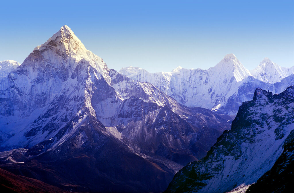
The Himalayas, forming the northern boundary of India, are one of the world’s youngest and loftiest fold mountain systems. Their origin dates back to about 50 million years ago, when the Indian Plate collided with the Eurasian Plate, pushing up sediments of the Tethys Sea and creating the world’s highest mountain ranges. Stretching for about 2,400 km from Jammu & Kashmir in the west to Arunachal Pradesh in the east, the Himalayas cover nearly 5 lakh sq. km, acting as a massive natural wall for India.
The Northern Plains of India, the Indo-Gangetic-Brahmaputra Plains, form one of the world’s most fertile and densely populated regions. Stretching about 2,500 km in length and 150–300 km in width, these plains extend from Punjab in the west to Assam in the east, covering parts of Punjab, Haryana, Delhi, Uttar Pradesh, Bihar, West Bengal, and Assam.
These plains were formed by the deposition of alluvium brought by the three great river systems, the Indus, Ganga, and Brahmaputra, along with their tributaries. Over millions of years, sediments filled the foredeep between the Himalayas and the Peninsular Plateau, giving rise to flat, fertile land.
Known as the “Food Bowl of India”, the Northern Plains produce a surplus of wheat, rice, sugarcane, pulses, and oilseeds due to fertile alluvial soil, flat relief, and ample water. They support some of the highest population densities in the world and are the backbone of India’s agrarian economy.
The plains are home to major cities like Delhi, Lucknow, Patna, and Kolkata, making them a hub of trade, industry, transport, and culture. The Northern Plains remain central to India’s agriculture, economy, and civilization with abundant rivers, fertile soil, and a favorable climate.
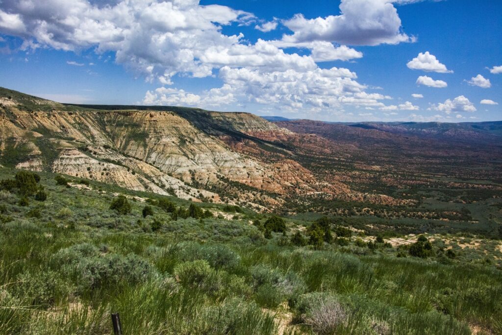
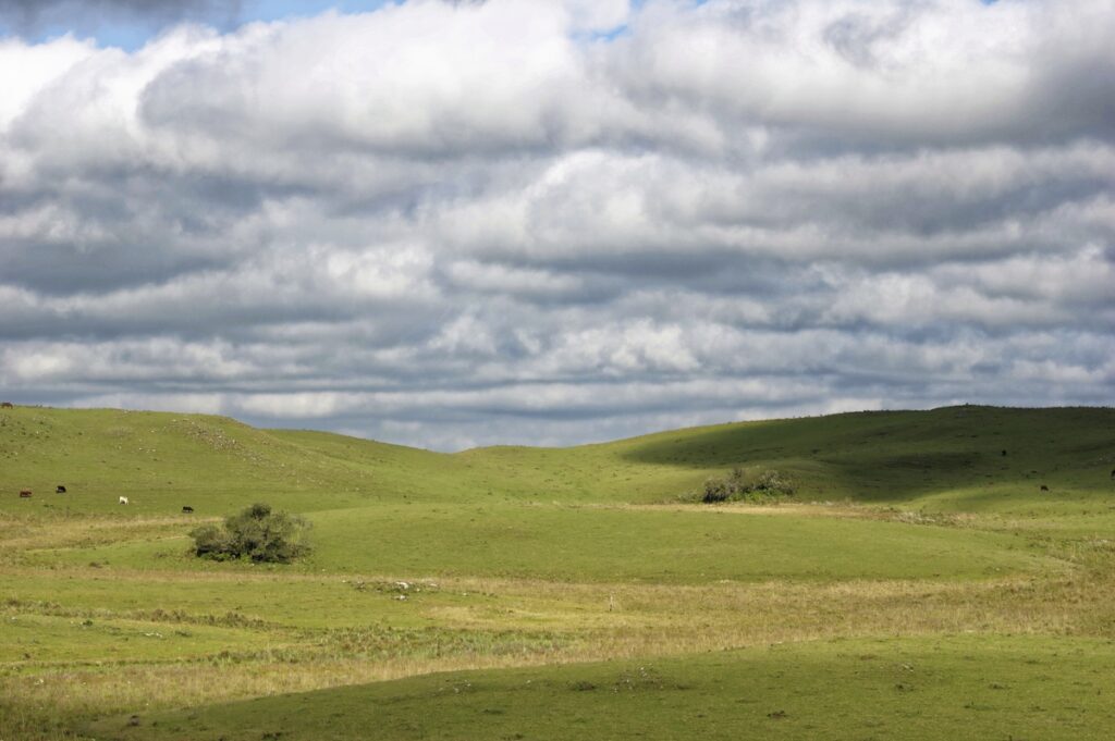
The Peninsular Plateau is one of India’s oldest and most stable physiographic divisions. Formed from the ancient Gondwana landmass, it comprises some of the world’s oldest crystalline, igneous, and metamorphic rocks, dating back more than 2.5 billion years. This plateau occupies the southern half of India, covering states such as Madhya Pradesh, Maharashtra, Karnataka, Andhra Pradesh, Telangana, Tamil Nadu, Odisha, and Jharkhand.
The Chotanagpur Plateau in Jharkhand is known as the “Ruhr of India” due to its rich mineral deposits. It contains vast coal, iron ore, copper, and mica reserves, powering India’s steel, energy, and industrial sectors. Ranchi, Jamshedpur, and Bokaro are critical industrial hubs located here.
The plateau is home to diverse tribal communities, ancient rock paintings, and essential temples like Hampi and Ellora. It has shaped regional culture, traditions, and settlement patterns.
Read More: Highest Plateau in the World

The Indian Desert, popularly known as the Thar Desert, lies in the northwestern part of India, covering western Rajasthan and parts of Gujarat. It extends across the international border into Pakistan and forms one of the most densely populated deserts in the world.
The region experiences an arid climate with extremely low and erratic rainfall (less than 150 mm annually). Summers are scorching, with temperatures often above 45°C, while winters are cool, creating a high diurnal and seasonal temperature range. Strong winds frequently cause dust storms and shifting sand.
The desert is characterized by:
Sparse xerophytic vegetation, like thorny bushes, acacia, and cactus, dominates the landscape. Wildlife includes the desert fox, chinkara, and the great Indian bustard. Human settlement relies on animal husbandry, handicrafts, and limited farming made possible by irrigation. The Indira Gandhi Canal has transformed parts of western Rajasthan into fertile land for wheat, mustard, and cotton cultivation.
The Thar Desert is a natural defense frontier with Pakistan and hosts key military bases. It is also a renewable energy hub, with vast potential for solar and wind power projects in Jaisalmer, Barmer, and Bikaner. Though arid, the Thar Desert is vital in India’s security, economy, and sustainable energy future.
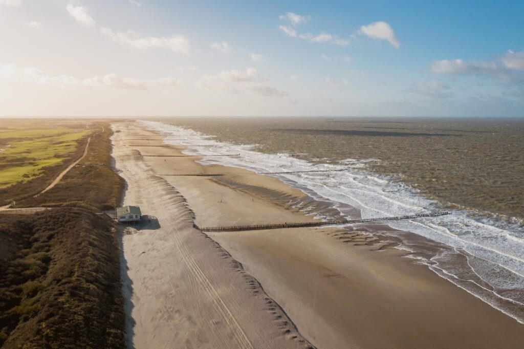
The Coastal Plains of India are narrow stretches of lowlands along the Arabian Sea in the west and the Bay of Bengal in the east. Together, they extend for about 6,000 km, forming a crucial interface between land and sea that supports agriculture, trade, tourism, and biodiversity.
| Feature | Eastern Coastal Plains | Western Coastal Plains |
|---|---|---|
| Location | Between the Eastern Ghats & Bay of Bengal | Between the Western Ghats & Arabian Sea |
| Width | 80–100 km (broader) | 50–60 km (narrower) |
| Rivers & Deltas | Wide deltas of Mahanadi, Godavari, Krishna, and Kaveri | Narrow estuaries, no major deltas |
| Agriculture | Rice cultivation, fertile soils | Coconut, spices, and cash crops |
| Examples | Coromandel Coast, Northern Circars | Konkan Coast, Malabar Coast |
The coastal plains, though narrow, are vital for fisheries, agriculture, tourism, ports, and biodiversity conservation, making them one of India’s most productive regions.

India has two major island groups: the Andaman & Nicobar Islands in the Bay of Bengal and the Lakshadweep Islands in the Arabian Sea. Though relatively small in area, these islands hold immense strategic, ecological, and economic significance.
Located 1,200 km from the mainland, this archipelago has more than 570 islands, islets, and rocks. They are of volcanic and tectonic origin, with Barren Island being the only active volcano in India. Rich in forests, coral reefs, and marine life, they are also home to indigenous tribes. Strategically, the islands host a major naval and air force base, giving India a commanding position over the busy Malacca Strait, a vital international trade route.
This group of 36 islands lies off the Kerala coast and is of coral origin, forming beautiful lagoons and reefs. With coconut cultivation, fishing, and eco-tourism as the main activities, Lakshadweep is known for its scenic beaches and fragile marine ecosystems.
The islands, though remote, are critical for national security, sustainable tourism, biodiversity conservation, and blue economy development.
| Division | Area Coverage | Elevation (approx.) | Key Features |
| Himalayas | Northern Boundary | 6,000+ meters | Young fold mountains, river origin |
| Northern Plains | Indo-Gangetic Belt | 200-300 meters | Fertile, densely populated, alluvial soil |
| Peninsular Plateau | Central & South India | 300-900 meters | Arid, dunes, saline lakes |
| Indian Desert | NW India (Rajasthan) | <200 meters | Ports, fisheries, agriculture, and tourism |
| Coastal Plains | Eastern & Western Coasts | 10-50 meters | Coral reefs, biodiversity, and strategic role |
| Islands | Bay of Bengal & Arabian Sea | Sea level | Coral reefs, biodiversity, strategic role |
These physical regions shape India’s geographical diversity and contribute to its cultural and economic richness.
India is usually divided into six physiographic divisions: the Himalayas, Northern Plains, Peninsular Plateau, Indian Desert, Coastal Plains, and Islands. However, some sources add a seventh division, the Central Highlands, which includes the Malwa Plateau, Bundelkhand, and Baghelkhand.
While most textbooks group these highlands within the Peninsular Plateau, others separate them due to their distinct relief, drainage (Chambal–Yamuna system), and geological traits.
For exams, the six-division model (NCERT/UPSC standard) is considered most reliable, though acknowledging both classifications shows clarity. In short, whether six or seven, these divisions highlight India’s diverse landforms and resources.
India’s geography is highly diverse, encompassing the Himalayas, the Northern Plains, the Peninsular Plateau, the Thar Desert, the Coastal Plains, and the Islands. Understanding its physiographic divisions helps explain variations in climate, rivers, soil, vegetation, and human settlement. Each division plays a key role: the Himalayas regulate monsoons and rivers, the Plains support agriculture and dense populations, the Plateau is mineral-rich, the Desert aids defense and renewable energy, the Coasts enable trade and fisheries, and the Islands enhance security and biodiversity.
For students and exam aspirants, remembering the six (or seven) divisions, their features, rivers, peaks, and economic significance is crucial. These divisions illustrate how India’s physical landscape shapes its climate, resources, culture, and civilization.
India’s physiographic division refers to classifying the country’s physical landscape into distinct regions based on geological structure, relief, and climate. India is divided into six major physiographic divisions: the Himalayas, the Northern Plains, the Peninsular Plateau, the Indian Desert, the Coastal Plains, and the Islands.
The three geological divisions of India are: The Himalayan Mountains (young fold mountains), The Peninsular Plateau (ancient stable landmass), and The Indo-Gangetic Plains (alluvial plains formed by Himalayan rivers).
Physiographic refers to the study or description of the physical features of the Earth’s surface, such as mountains, plains, plateaus, deserts, and rivers, focusing on their form, structure, origin, and spatial distribution.
Latitude is a geographic coordinate that measures the distance north or south of the Equator, expressed in degrees. It ranges from 0° at the Equator to 90° at the poles. Lines of latitude, or parallels, run horizontally around the Earth and help determine climate zones and navigation.
Physiographic regions are defined by physical characteristics such as landform structure, elevation, geological composition, and climate. These regions have uniform terrain features, like mountains, plains, or plateaus, formed through specific geological processes. They help understand natural resource distribution, ecological zones, and patterns of human settlement and development.