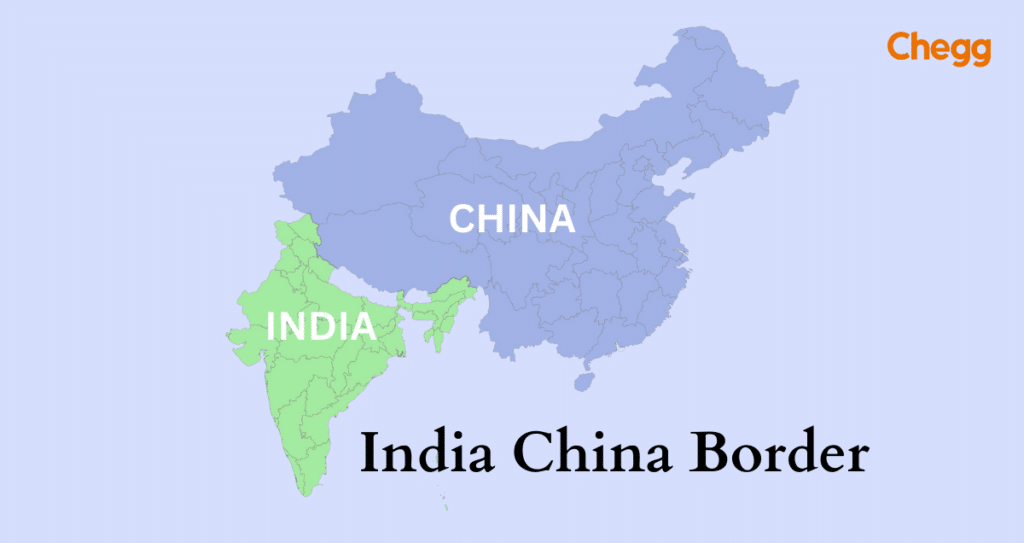
The India-China Border spans approximately 3,488 km and is divided into three sectors: Western, Middle, and Eastern.
Disputes are prominent in areas like Aksai Chin (Western), Arunachal Pradesh (Eastern), and some portions of the Middle Sector.
The Line of Actual Control (LAC) serves as the de facto border, although it’s not fully demarcated. Tensions, including the 1962 war and the 2020 Galwan Valley clash, have led to ongoing disputes and military stand-offs between the two nations.
Table of Contents
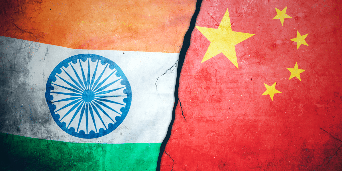
The India China border is one of the most sensitive and disputed frontiers in Asia. Stretching nearly 3,488 km across Jammu & Kashmir, Himachal Pradesh, Uttarakhand, Sikkim, and Arunachal Pradesh, it is marked by the Line of Actual Control (LAC). Due to its undefined nature, the border has often sparked tensions, most notably the 2020 Galwan Valley clash, making it a hotspot of military and diplomatic challenges.
China’s recent actions, like renaming areas in Indian territory and limiting visas for Indian media, along with hawkish statements from their leader, have fueled suspicions about China’s intentions. This has prompted India to strengthen its defenses in preparation for any possible threats.
India China Border Dispute History
The India China Border conflict is complex and requires historical context. Imperial and colonial ambitions shaped the region. The British Empire’s rule in India and the Qing Dynasty’s fall changed their borders. The 1914 Simla Convention, which included China, Tibet, and British India, established the McMahon Line as a tourist attraction despite China’s disagreement.
India China Border Clashes and Standoff
1962 India China War: This conflict occurred between India and China from October 20 to November 21, 1962. Despite India’s weaker material resources, Chinese forces advanced into Arunachal Pradesh before retreating later.
2017 Doklam Standoff: Tensions rose when China began building a road from Dokola towards a Bhutanese army camp near the Sikkim sector, close to the Chumbi Valley. Accusations of violating agreements worsened India China relations.
2020 Galwan Valley Clash: This was the deadliest conflict since 1962. On June 15, 2020, Indian and Chinese soldiers clashed in the Galwan Valley, resulting in the deaths of 20 Indian and 5 PLA soldiers. The exact casualty figures remain disputed.
Tawang Dispute 2022: Tawang, a part of Arunachal Pradesh, was contested by both India and China. Though India lost it during the 1962 war, it was later returned. Tawang is notable as the Dalai Lama’s escape route in 1959. The disputed boundary here remained a point of contention.
The Strategy Behind the Clashes: More Than Just Rocks and Sticks
The images of soldiers fighting with clubs and spikes in the Galwan Valley shocked the world, but these confrontations are not random – they are carefully planned. The medieval-looking weapons follow strict modern rules.
The 1996 Agreement on Confidence-Building Measures bans firearms, explosives, and chemicals within two kilometers of the Line of Actual Control (LAC). While meant to prevent full-scale war, it has shaped a unique form of conflict that benefits China.
Why the “no-guns” rule continues:
Controlled escalation: China can press territorial claims and show strength without sparking full-scale war. It’s a “slow boil” strategy- pushing limits while avoiding total conflict.
Internal doctrine: The approach mirrors China’s internal security model, favoring large, static forces to hold positions steadily without unpredictable escalation.
In short, the brutal hand-to-hand combat is a loophole in diplomacy, a way to fight without officially declaring war. The border clashes are not isolated incidents but strategic moves in a long-term game.
Factors and Geopolitics
India China Border dispute reveal deeper-rooted problems and global implications.
Core issue: Ongoing India-China conflict over the border between India and China.
Line of Actual Control divides Indian and Chinese-administered areas but lacks complete demarcation due to different interpretations and frequent clashes.
China’s Belt and Road Initiative:
Aims to enhance regional influence through infrastructure projects.
China-Pakistan Economic Corridor (CPEC):
An integral part of the Belt and Road Initiative.
It passes through Pakistan-occupied Kashmir, which India claims as its territory.
Territorial concerns and India- China political tensions increase.
Geopolitical Significance of Tibet:
Tibet borders India.Tibetan issues complicate matters.The Chinese occupation of Tibet impacted India China relations.
India is affected by Tibet beyond China’s strategic advantages.
India China Border Dispute
India and China’s border disputes, usually along the Line of Actual Control, center on the unresolved border dispute. This conflict involves land claims, myths, and universal goals.
Ongoing Border Dispute Between the Two Countries
An unclear border (Line of Actual Control) due to conflicting historical views leads to transgressions and tensions between India and China.
Past agreements and practices managed the dispute, but reaching a final solution is hindered by strong national positions.
Claim History and Disputes
Disputed Territories:
Aksai Chin (Western Himalayas): Aksai Chin is a strategically significant region under Chinese control but claimed by India as part of Ladakh. The area connects Tibet to Xinjiang and was a major point of contention in the 1962 war. India maintains that historical boundaries support its claim, while China cites historical governance to justify its control.
Arunachal Pradesh (Northeastern India): Arunachal Pradesh, referred to by China as “South Tibet,” is a key region in the eastern sector of the border. Disputes here revolve around historical maps and differing interpretations of the McMahon Line. India regards Arunachal Pradesh as sovereign territory, while China maintains historical claims.
Causes of Tension:
Tensions between India and China arise from historical claims and unclear borders. Despite diplomatic efforts, disputes persist due to colonial-era treaties, strategic significance, and competition over land and resources. The lack of a formal resolution has led to frequent skirmishes and standoffs, keeping the region a constant source of geopolitical tension.
India China Border Gates and Infrastructure
Both India and China have invested heavily in border infrastructure to improve mobility, surveillance, and defense capabilities. Roads, military posts, and dual-use installations enhance monitoring and security, while advanced technologies such as drones and satellite surveillance increase situational awareness. Constructing infrastructure in remote, high-altitude regions is challenging due to environmental conditions, difficult terrain, and engineering constraints. Despite these obstacles, both nations prioritize connectivity and strategic readiness along the LAC.
India China border dispute by sector
The India-China border is divided into three sectors:
Western Sector (Ladakh):
Spanning roughly 2,152 km, it includes the disputed Aksai Chin region.
Historical proposals like the Johnson Line (favored by India) and McDonald Line (favored by China) contributed to unresolved claims.
Middle Sector (Uttarakhand, Himachal Pradesh):
Spanning about 625 km, disputes are fewer but involve border demarcation in areas like Barahoti and Sang-Nelang.
Eastern Sector (Arunachal Pradesh, Sikkim):
Extends roughly 1,140 km and includes Tawang and Longju.
Disputes center on the McMahon Line, which China does not recognize.
The LAC serves as the de facto boundary in all sectors, though its exact alignment remains contested.
India China Border Length and Name
India China border is one of the longest global borders at 3,488 kilometers. This border has Himalayas, valleys, and rivers. Its large border with China shows India’s strategic importance in Asia.
China and India’s de facto border is the Line of Actual Control. Politics, treaties, and bloodshed created the LAC. This reveals the nerve centers of communication between the two nations. No one has drawn this boundary, causing tension, confusion, and conflicts.
India China Border name list
Western Sector (Ladakh):
Aksai Chin: A region disputed between India and China, currently controlled by China but claimed by India.
Shaksgam Valley: Disputed region ceded by Pakistan to China in a 1963 border agreement, but claimed by India as part of Jammu and Kashmir.
Middle Sector (Uttarakhand, Himachal Pradesh):
There is no major territorial dispute here, but there are several border regions that need demarcation. The line of control here is mostly agreed upon.
Eastern Sector (Arunachal Pradesh):
Tawang: A key area disputed by China, which claims it as part of Tibet, but India controls it.
McMahon Line: A border line agreed upon in the 1914 Simla Accord between British India and Tibet, which China does not recognize.
Longju: A disputed area near the McMahon Line.
Indo China Tibetan Police
The ITBP was established in 1962 to secure the India-China border, especially in high-altitude areas. It operates from Ladakh’s Karakoram Pass to Arunachal Pradesh’s Jachep La, supporting both military operations and civilian security.
Key functions include:
Patrolling the high-altitude border.
Preventing illegal crossings and smuggling.
Assisting in disaster management and anti-Naxal operations.
The ITBP operates under the Ministry of Home Affairs and has evolved from a paramilitary unit to a specialized high-altitude force, reflecting the strategic importance of the border.
Challenges Along the Border
Border Skirmishes and Security Incidents: Periodic military standoffs, such as the Galwan Valley clash (2020), have highlighted the volatile nature of the border. The police and border forces on both sides often have to respond to sudden flare-ups, requiring coordinated efforts with military forces.
Smuggling and Illegal Crossings: Both India and China have to address illegal immigration, smuggling, and cross-border trade, which is often handled by the police and paramilitary forces stationed in remote border areas.
Tibetan Refugee Issues: China heavily controls movement in and out of Tibet, and India has been a refuge for thousands of Tibetans fleeing Chinese rule. The Tibetan refugee issue has often been a source of friction between India and China, with the Tibetan exile police playing a role in managing refugee populations.
Effective management requires coordination between paramilitary forces, military units, and local administrations to maintain security and prevent escalation.
Himachal Pradesh (Lahaul and Spiti, Kinnaur District):
China claims the Kaurik region in the Lahaul & Spiti districts and the Tashigang-Shipki La area in the Kinnaur district as part of its Tibet province.
Uttarakhand (Uttarkashi, Chamoli District):
China claims the Sang-Nelang-Pulam Sumda area in Uttarkashi district and the plains of Barahoti in Chamoli district as part of its Tibet province.
Arunachal Pradesh:
China claims the entire state of Arunachal Pradesh, referring to it as South Tibet.
Taiwan, with which India maintains friendly relations, also claims parts of Arunachal Pradesh.
Sikkim (Doklam):
In the Doklam Valley near the trijunction of India, China, and Bhutan, China attempted to build a road through the disputed Doklam Plateau region.
This area, about 100km in size, is bordered by the Ha Valley of Bhutan, the Chumbi Valley of Tibet (China), and the Indian state of Sikkim, which is claimed by both China and Bhutan.
Diplomatic Efforts and Agreements
Over the decades, India and China have pursued various diplomatic initiatives:
1914 Shimla Convention: Established the McMahon Line, rejected by China.
Panchsheel Agreement (1954): Emphasized sovereignty and non-interference.
1989 Joint Working Group: Aimed at confidence-building measures (CBMs).
1993 Peace Agreement: Promoted stability along the LAC.
1996, 2005, 2013 CBM Agreements: Strengthened protocols for non-aggression and peaceful conflict management.
Despite these efforts, unresolved disputes and differing strategic goals continue to challenge diplomacy.
Battle of Galwan and Military Protocol
The Galwan Valley clash illustrates the LAC’s unique rules of engagement. Soldiers adhered to agreements prohibiting firearms, engaging in hand-to-hand combat instead. This approach reduces the risk of all-out war while allowing both sides to assert presence. The event emphasized the need for continued vigilance, infrastructure development, and diplomatic dialogue.
Why firearms were not used:
Agreements explicitly prohibit guns and explosives near the LAC.
Non-lethal confrontations are standard to maintain controlled escalation.
Protocols have prevented firearm use since 1962, demonstrating commitment to conflict management.
Why did the Indian peaceful resolution and non-aggression. Adherence to these pacts has prevented a single shot from being fired on this border since 1962, making controlled, non-firearm confrontations a standard protocol to prevent all-out war.
Possible alternatives to solve the Dispute
Encourage Bold Imagination: Political leaders must boldly use their imagination to assert influence over China.
Embrace Proactivity: India must take proactive steps in its dealings with China, as Beijing rarely compromises unless under pressure.
Execute Tactical Measures on LAC: Tactical actions on the Line of Actual Control (LAC) should be bold, and the military should be employed to achieve policy objectives and assert dominance over the adversary.
Enhance Strategic Thinking: Delhi must adopt bold and innovative strategic thinking to seize the initiative from China.
Overcome Fear of Military Escalation: India’s apprehension of military escalation hampers progress in resolving the Ladakh border issue, and the government must overcome this fear to take proactive measures.
Leverage Diplomatic Channels: India should utilize diplomatic avenues and international platforms to exert pressure on China to address the border dispute.
Build Domestic Capacities: India should prioritize the development of domestic capabilities, both military and economic, to match China’s strengths and enhance its bargaining position in negotiations.
The Evolving Border: Recent Developments and Local Voices
The India-China border dispute remains dynamic, shaped by new policies and local unrest.
Ladakh’s Protest for Autonomy: In 2024, mass protests led by Sonam Wangchuk demanded statehood and constitutional protections for Ladakh. This civil unrest highlights how border tensions directly impact local communities, who fear for their land and cultural future without political autonomy.
New Civilian Militia Plan: India plans to raise a “Border Wing Home Guards” force, recruiting local youths to act as the “eyes and ears” of the military. This initiative aims to improve intelligence gathering and secure remote areas along the LAC.
Ongoing Diplomacy: Despite stalemates, both nations continue diplomatic talks on new Confidence-Building Measures (CBMs), underscoring that dialogue remains the preferred path to manage tensions.
India China Border UPSC
The India China border dispute is a long-lasting geopolitical challenge.
The primary point of contention lies along the Line of Actual Control (LAC), which stretches approximately 3,488 kilometers.
The dispute has its origins in the early 20th century:
The Shimla Convention of 1914 attempted to demarcate the border between Tibet and British India.
Disagreements persisted, leading to the unresolved status of territories like Aksai Chin and Arunachal Pradesh.
Tensions escalated dramatically in 1962 during the Sino-Indian War:
The war resulted in significant casualties and territorial gains for China.
Efforts to ease tensions through diplomatic negotiations and confidence-building measures followed, including the 1993 Agreement on the Maintenance of Peace and Tranquility along the LAC.
Aksai Chin:
An area claimed by both India and China.
China has maintained control over the region since the 1962 war.
In the eastern sector:
China claims Arunachal Pradesh as part of its territory (known as South Tibet).
India contests this claim.
Efforts to address the border dispute include bilateral talks, military disengagement agreements, and confidence-building measures, but progress remains challenging due to strong positions and strategic considerations on both sides.
Conclusion
The India China border remains a critical geopolitical flashpoint shaped by history, territorial claims, and military standoffs. Stretching across five Indian states, it is defined by the Line of Actual Control (LAC) but continues to face disputes in regions like Aksai Chin and Arunachal Pradesh. While agreements aim to maintain peace, incidents like Galwan show volatility persists. The future of this border depends on dialogue, diplomacy, and balanced security measures to ensure stability in South Asia.
Frequently Asked Questions:
What is the India China border called?
The de facto boundary between India and China is called the Line of Actual Control (LAC), marking areas each side controls. In the northeast, the McMahon Line is a historic boundary India recognizes (but China disputes).
What is the length of the China and India border?
The 3488 km border between India and China passes through the states of Arunachal Pradesh, Himachal Pradesh, Uttarakhand, Sikkim, and Jammu & Kashmir.
What is LAC or LOC?
Line of Control is referred to as LOC. The line of defense (LOC) is a nation’s physically designated, military-marked, or military-supervised border. LAC, on the other hand, stands for the Line of Actual Control. This LAC, which is a military-manned, politically-backed border as opposed to one that is marked on a map, came into being in 1993 as a result of a bilateral agreement.
What is “body walls” meant in border security?
“Body walls” refer to the strategic and physical barriers created by border infrastructure to prevent unauthorized access and deter conflicts. These barriers not only serve local security needs but also have wider geopolitical effects.
Who guards the India-China border?
The Indo-Tibetan Border Police (ITBP) is mainly responsible for guarding the India-China border. They patrol the high-altitude areas and maintain security along the Line of Actual Control (LAC).
How many borders are there between India and China?
India and China share one long disputed land border, commonly demarcated by the LAC (Line of Actual Control), spanning around 3,488 km.
Can we visit India-China border?
You can visit some border areas such as Nathu La in Sikkim, which is an open trade/pass border post. But most stretches, especially in Aksai Chin or disputed zones, are closed to civilians.
What are the 7 borders of India?
India shares land borders with 7 countries: Pakistan, China, Nepal, Bhutan, Bangladesh, Myanmar, and (disputed) Afghanistan.
Authored by, Muskan Gupta Content Curator
Muskan believes learning should feel like an adventure, not a chore. With years of experience in content creation and strategy, she specializes in educational topics, online earning opportunities, and general knowledge. She enjoys sharing her insights through blogs and articles that inform and inspire her readers. When she’s not writing, you’ll likely find her hopping between bookstores and bakeries, always in search of her next favorite read or treat.